Graphic editing in the Plot View
Graphic Editing in the Plot View
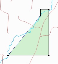
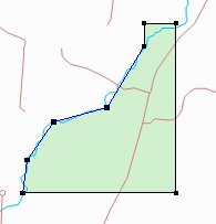
In addition to editing a deed’s text in order to change its shape you can directly modify the parcel by graphically editing it in the Plot View. There are two main reasons to do this. First, the property might have a meander line and you’d like to have the parcel closely fit the stream. So you use graphic editing commands to replace the unspecified meander line with new points in the deed and then position them along the watercourse, as described below.
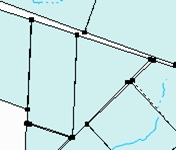
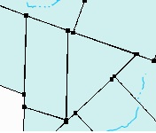
Second, you might be preparing to save a graphic file of the Plot View and you want to clean up the parcels by adjusting the property corners so there are no gaps or overlaps. This kind of editing is destructive in that the original survey information is replaced.
It can take a bit of practice to become comfortable with graphic editing. It’s recommended that you save your deed file before you begin.
Undo support
Graphic editing commands can be reversed with the Edit>>Undo command.
Inserting a new point in a survey line
First, select the parcel you want to modify. Then press and hold the Alt key while clicking one time at the location on a property line where you want the new point to be inserted.
Dragging a survey point
First, select the parcel you want to modify. Then press and hold the Alt key while positioning the mouse over the point you want to move. It will be highlighted with a box, as shown.

Once the box appears, press the left mouse button (while still using the Alt key) and drag the point to its new location. Release the mouse button and release the Alt key to complete the operation.
Deleting a survey point
First, select the parcel you want to modify. Then press and hold the Alt key while positioning the mouse over the point you want to delete. It will be highlighted with a box as shown above. While continuing to press the Alt key, click the right mouse button and select Delete.